The traditional tools of archaeology, spades, brushes, and notebooks are still used, but they’re now just part of a much wider toolkit. Modern battlefield archaeology has embraced technologies that reveal what lies beneath the surface without disturbing it, helping researchers locate lost battlefields, understand how engagements unfolded, and rehumanise the people involved. These tools have already redefined what we know about several key historical sites.

Ground-Penetrating Radar (GPR)
GPR has been pivotal at the Battle of Towton site in Yorkshire, where mass graves from England’s bloodiest medieval battle were first confirmed in the 1990s. Since then, surveys have expanded using GPR to detect anomalies linked to unexcavated burial pits and defensive positions, helping clarify where hand-to-hand fighting was most intense.
At Culloden, Scotland’s last pitched battle in 1746, GPR revealed the full extent of Jacobite trenchworks and helped preserve sensitive zones from development. These findings reshaped battlefield zoning policies by Historic Environment Scotland.
LiDAR and Aerial Scanning
In Teutoburg Forest, Germany, LiDAR helped map long-lost Roman military roads and ditches. The aerial scanning stripped away dense forest cover to show a clear, linear ambush point, matching ancient accounts of where Germanic tribes annihilated three Roman legions in 9 AD. This helped confirm the site at Kalkriese as the battle location.
Similarly, at the Battle of Bosworth Field (1485), LiDAR supported terrain reconstructions that led to the discovery that the actual battlefield was a mile from the previously accepted site. This shift was later reinforced by metal-detected finds (notably cannonballs and lead shot), changing the narrative of Richard III’s final stand.
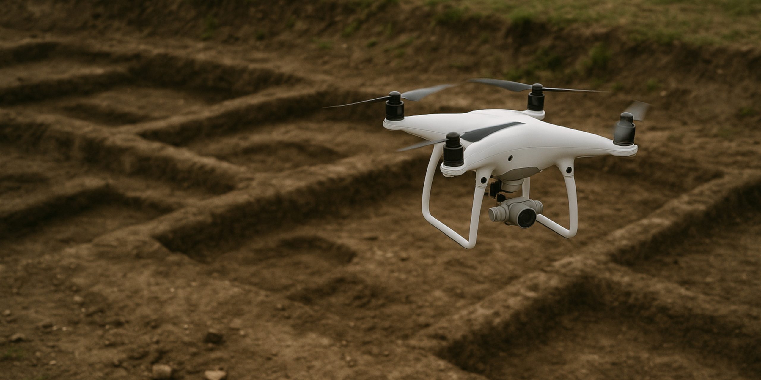
Drones and High-Resolution Mapping
During ongoing research at Waterloo (1815), drones have been used to map and monitor excavation areas across the massive battlefield. Drone footage has helped pinpoint subtle changes in terrain and revealed features like collapsed field boundaries and shallow trench remnants, which aided in locating a long-lost Allied field hospital and mass burial zones.

Systematic Metal Detection
The Battle of Little Bighorn (1876, Montana, USA) was one of the first battlefields where metal detection was applied in a fully archaeological framework. Hundreds of cartridges and bullets were GPS-plotted to map out firing positions, revealing troop dispersal and refuting longstanding myths about Custer’s final moments.
In the UK, metal detection played a crucial role in uncovering the real site of Bosworth, with items like a silver-gilt badge of Richard III’s boar emblem recovered far from the visitor centre’s previous location. The spatial distribution of artefacts like lead shot and artillery fragments allowed historians to redraw troop movement maps.

Forensics and Isotope Analysis
The mass grave at Towton has yielded deep insight through forensic analysis. Skeletal trauma revealed many combatants were killed from behind or after falling, suggesting chaotic routs or post-battle executions. Isotope analysis indicated that some soldiers were raised outside of Yorkshire, supporting the idea of a broad national mobilisation.
At Visby (1361, Gotland, Sweden), well-preserved skeletons wearing armour were studied using similar methods. Forensics showed catastrophic injuries, many to the legs, indicating that peasant soldiers were likely cut down while fleeing, contradicting romanticised depictions of honourable stand-offs.
Each layer of technology from airborne LiDAR to microscopic isotope analysis, adds a new dimension to battlefield archaeology. These tools not only reshape our understanding of historical events but also ensure that sites of human suffering are treated with respect and accuracy. The past is no longer just unearthed; it’s mapped, scanned, and reconstructed with the precision once reserved for forensic science and engineering.