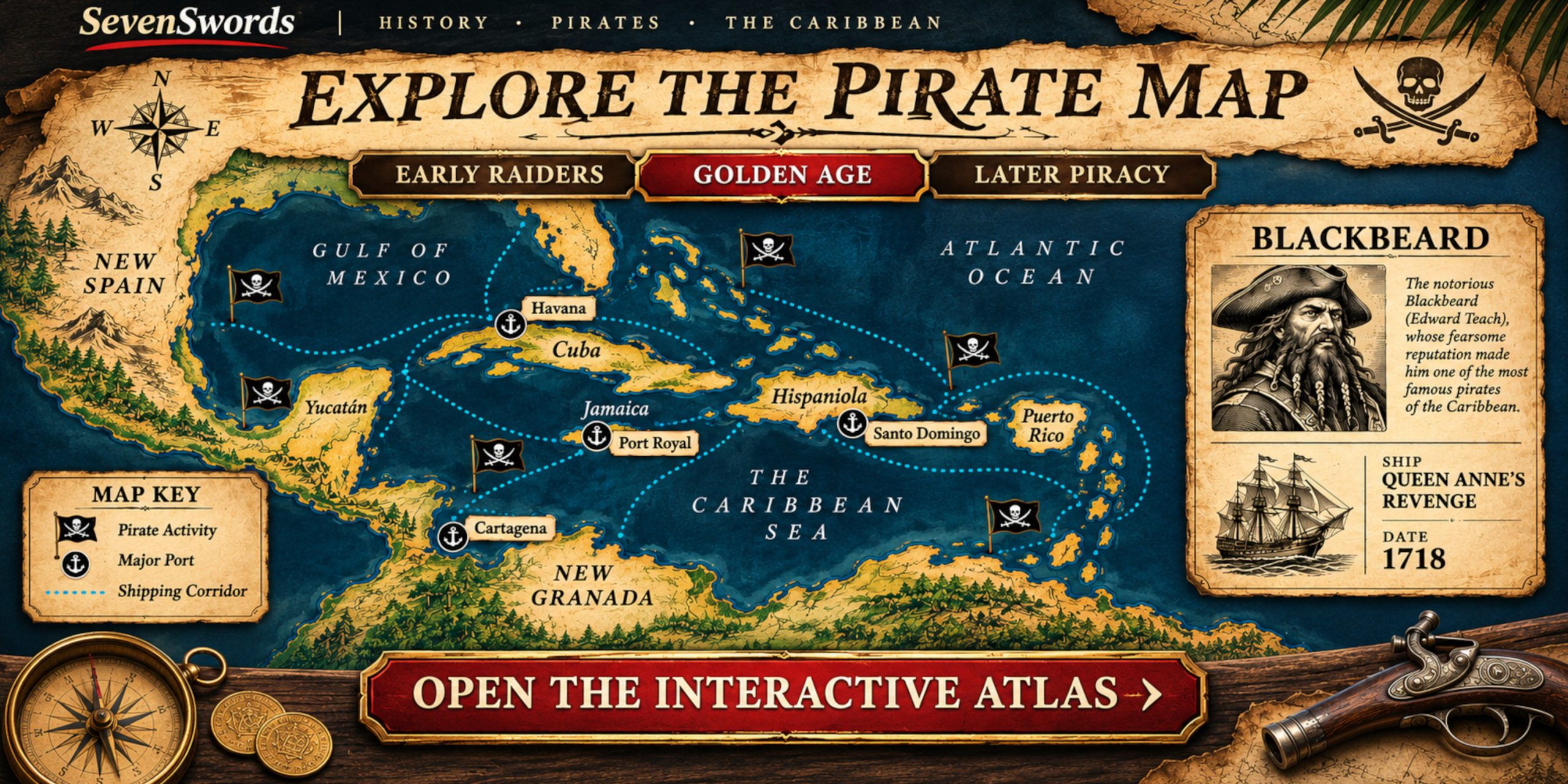
A pirate’s reputation could travel faster than his ship. Blackbeard understood that rather well. Yet the Caribbean’s history was shaped by more than notorious captains: colonial wars, valuable shipping, vulnerable ports and people forced across the Atlantic all belonged to the same maritime world.
The SevenSwords Caribbean Pirate History Map puts that world on screen. Move between three historical periods, select a person or place, and follow the records behind the story. Its 35 profiles cover pirates, corsairs and privateers from the sixteenth to the early nineteenth century. Ships, activities, fates and sources sit alongside the map, so an interesting flag can lead somewhere more useful than another tale of buried treasure.
Hoist the colours: open the interactive map
The live Golden Age viewer shows pirate markers, ports, broad shipping corridors and the map’s period controls.
Begin before the Golden Age
The famous pirates of the early eighteenth century did not appear out of an empty sea. European powers had been fighting over Caribbean trade and territory for generations. The atlas begins with Early raiders, 1500–1649, including Francis Drake, French corsairs and Dutch commanders. It then moves to the broader Golden Age, 1650–1730, before following Later piracy, 1731–1830. Historians draw the Golden Age’s boundaries differently; the atlas explains its choice rather than presenting a tidy date as settled fact.
Drake makes a useful first stop. To an English patron, his raids could be celebrated as service to the Crown. To Spain, an English commission offered little reassurance. His profile places attacks on Spanish possessions beside his involvement in the Atlantic slave trade. It also keeps his Caribbean campaigns distinct from his wider voyages, a small correction to the habit of putting the Golden Hind into every Drake story.
Choose an era to see the figures, ports and corridors relevant to that period.
Meet the people behind the flags
The Golden Age view brings together familiar names such as Blackbeard, Henry Morgan, Calico Jack Rackham, Anne Bonny and Mary Read. Select a marker or browse the list to open a profile with a person’s ships, key events, final fate and further reading. The records make room for uncertainty where the sources demand it.
That matters particularly for Bonny and Read. Both belonged to Rackham’s crew, but later writing has supplied far more detail about their lives than the surviving evidence can safely bear. The atlas records Read’s death in prison and leaves Bonny’s eventual fate unknown. Henry Morgan presents a different problem: the line between commissioned violence and piracy depended considerably on who was issuing the commission, and who had just lost a port.
The black flags are generic map markers, not verified reproductions of each person’s flag. Likewise, the dotted circles indicate approximate regional activity. They do not claim that a captain attacked every shore within them. That makes the map useful for exploring relationships between places without turning an editorial illustration into an invented itinerary.
Follow the cargo
Pirates went where ships had reason to sail. The atlas shows broad corridors connected with Spanish treasure fleets, Atlantic approaches, the Florida Straits, the Windward Passage and plantation exports. It also includes the forced Atlantic passage to Caribbean markets, keeping enslaved people within the history of this trade rather than treating the sea as a stage set for adventurous captains.
Ports and anchorages help make sense of the geography. Nassau, Port Royal, Havana and Cartagena played different roles in a region where commerce, warfare and raiding repeatedly crossed paths. Select a port anchor or shipping lane for its record and context. The lines show schematic corridors, not a ship’s documented track on a particular voyage.
Where the ships came to rest
Wrecks offer a different kind of evidence from a captain’s account or a colourful biography. The viewer includes identified records for Queen Anne’s Revenge, Whydah Gally and Quedagh Merchant, with links to archaeological work. It also shows the documented loss area associated with Morgan’s fleet while leaving individual wreck identification unconfirmed. The displayed positions are approximate reference points, not dive coordinates.
Select Show wrecks and use the wreck list to investigate each record. Blackbeard’s ship is especially revealing: it began as the French slave ship La Concorde before he captured and renamed it in 1717. The wreck connects the celebrated pirate story to the maritime economy from which it emerged.
The live wreck view isolates identified sites and the separately marked unconfirmed loss area.
Take a route of your own
Start with a name you know, or choose a period you know little about. Search a ship, open a port, follow a shipping corridor, then check the sources attached to the records. The map rewards that sort of wandering. Pirate history often does, provided someone has kept hold of the evidence.