A battle can occupy three paragraphs in a history book and several miles of difficult ground. Between the two lie river crossings, steep slopes, awkward roads and the occasional commander who appears to have noticed none of them.
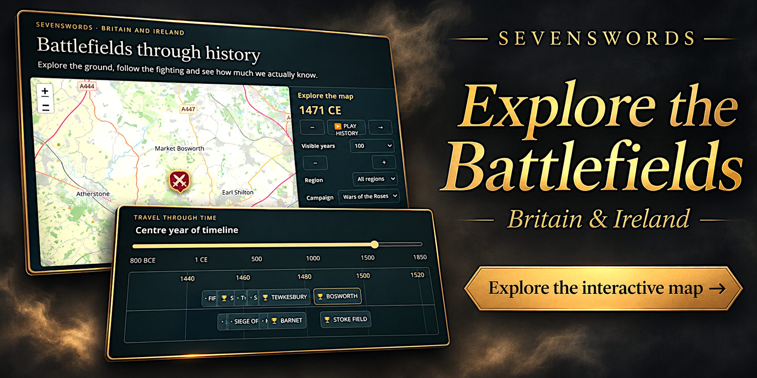
Our new interactive battlefield map of Britain and Ireland brings geography back into the story. Combining a map, a moving timeline and individual historical entries, it offers a different way to explore the conflicts that shaped England, Scotland, Wales and Ireland.
At launch, the atlas contains 191 entries spanning 43 CE to 1798. These include battlefield landscapes, sieges, urban destruction sites and disputed locations, with notes explaining what each marker actually represents.
Choose a period, follow a campaign or investigate the fighting near somewhere you know. Familiar names become rather more interesting when you can see their neighbours.
A Battlefield Map That Moves Through History
Reading about battles individually can leave them floating in splendid isolation. A map restores the connections between places. A timeline helps restore the sequence.
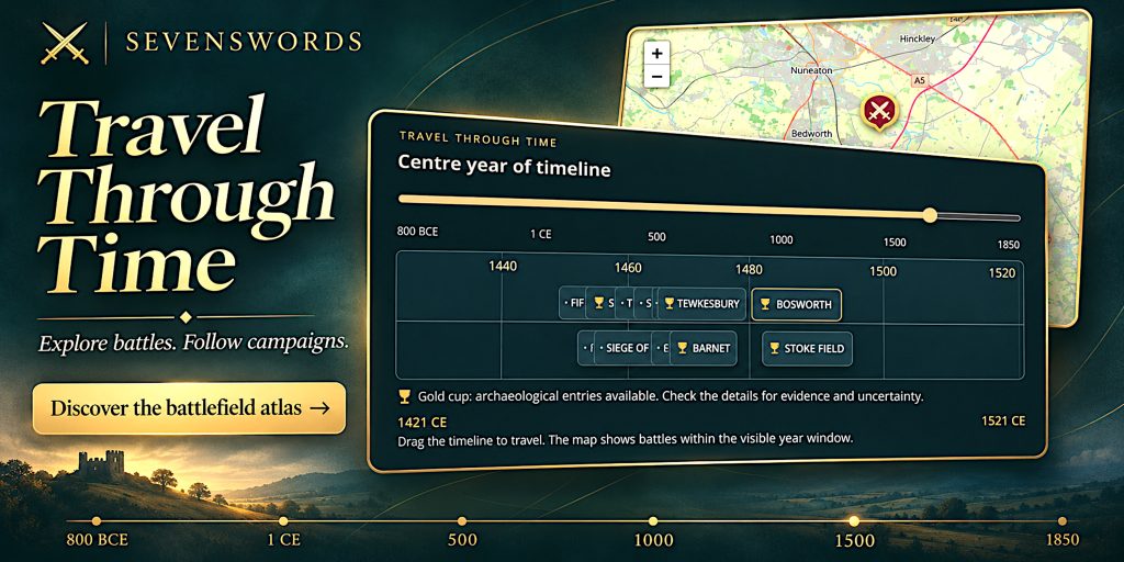
The SevenSwords atlas links the two. Move through the years and the map displays entries within the selected period. Narrow the window to examine a particular stretch of history, or widen it to see conflicts across several centuries.
You can drag the timeline, use the year slider or move in sections with the arrow buttons. There is also a “Play history” control for moving through time automatically.
That makes the atlas useful for more than finding a single battlefield. It allows you to follow the changing geographical focus of warfare and ask why particular districts appear repeatedly. A river crossing rarely becomes strategically irrelevant because a dynasty has changed its stationery.
Open the battlefield map and timeline.
Explore Battlefields Across England, Scotland, Wales and Ireland
The regional filters let you concentrate on England, Scotland, Wales or Ireland, while the campaign filter provides another route into the material. You can also search by battle name, place or words in the descriptions.
The coverage stretches from the Roman invasion and Boudiccan revolt to medieval warfare, the Civil Wars, Jacobite campaigns and the Irish rebellion of 1798.
There is room for both recognised battlefield landscapes and events whose locations remain frustratingly elusive. Entries such as Mons Graupius and Boudica’s final battle make the uncertainty part of the history, rather than tidying it away.
That breadth is one reason I find a mapped approach so rewarding. You might arrive looking for a particular engagement and leave wondering about a nearby siege, a failed relief expedition or a battle you have somehow managed to overlook for twenty years.
Look for the Gold Cup: Archaeology Behind the Battles
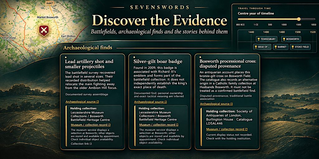
Names marked with a gold cup have archaeological entries available. Open their details to investigate the recorded finds, supporting sources and qualifications attached to the evidence.
These records can include ammunition, weapons, clothing fittings, human remains and material associated with the destruction of settlements. Some entries also identify holding collections or museums, with notes about display availability.
Bosworth is a particularly useful example of why this matters. Archaeological investigation changed the accepted focus of the battlefield away from the older interpretation centred on Ambion Hill. The landscape familiar from visitor tradition and the landscape suggested by recovered evidence need not be identical.
The Boudiccan entries raise a different question. Burnt material from Roman towns can provide evidence of destruction without locating a fighting line or identifying the people responsible for every deposit.
The gold cup therefore means there is evidence to examine. It does not mean that every object has an unquestionable connection to the battle. A musket ball comes without a helpful label naming its owner.
Known Battlefields, Disputed Sites and Honest Gaps
One of the atlas’s most useful features is its treatment of location evidence.
Some battles can be placed within a recognisable surviving landscape. Others belong to a broad district, a traditional identification or one of several competing hypotheses. The entries distinguish between these situations and explain the reasoning where available.
Dashed areas indicate uncertain locations or research suggestions. They are not proven battlefield boundaries. Even a confidently placed marker should not be read as an exact outline of the fighting.
This is especially important for early battles. A written account may describe a river, woodland and rising ground without giving us enough information to identify a modern field. Britain and Ireland have, rather inconveniently, more than one example of each.
The map uses present-day geography for orientation. Rivers, coastlines, drainage and settlement may have changed since the events described, so the modern landscape is a starting point for interpretation.
How to Use the Interactive Battlefield Atlas
A useful first visit takes only a few steps:
- Choose a region to focus on England, Scotland, Wales or Ireland.
- Select a campaign or adjust the timeline to reduce the number of events shown.
- Search for a battle or place if you have a particular subject in mind.
- Open an entry to read its history, landscape notes and location evidence.
- Check gold-cup entries for archaeological records and collection information.
For a broader browse, widen the visible years and move between regions. For closer study, narrow the period and compare neighbouring engagements.
The page also includes a written directory of battlefield histories and sources beneath the interactive feature. It provides another way to explore the material, including when the interactive map is unavailable.
A Starting Point for Battlefield Visits and Further Reading
The atlas can help you build a shortlist of places to investigate, whether you are planning a historical trip or researching your own area.
Start with the location notes. They help distinguish a surviving battlefield from a broad area of interest, and a commemorative landmark from evidence of where the fighting occurred. A memorial marks an act of remembrance; its position does not automatically settle a tactical argument.
Where collections are listed, check the individual display notes before travelling. An object held by a museum is not necessarily on public display. Likewise, a map marker does not establish public access to the surrounding land.
Used alongside local heritage information, the atlas offers a useful bridge between reading about a battle and understanding its setting.
Start Exploring Britain and Ireland’s Military History
The pleasure of a historical map is often the question it leaves you with. Why did an army fight there? What made that crossing worth defending? How much of the familiar story survives contact with the archaeological record?
The new SevenSwords feature gives you places, dates and sources from which to begin answering those questions, while keeping the uncertain ground visible.
Explore the Battlefields of Britain and Ireland: Interactive Map and Timeline.
For a wider chronological view, continue with the SevenSwords World at War Timeline.